
Reviewed · HIKING & TREKKING
Santiago: Monte Tchota Natural Park to Pico d’Antónia Hike
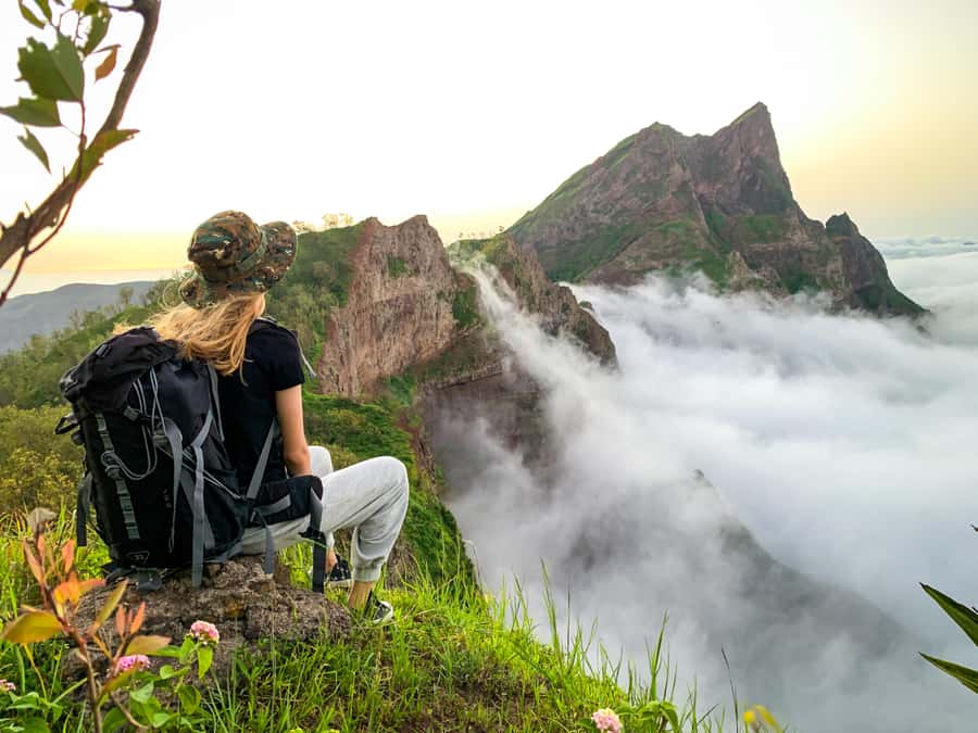
Pico d’Antónia is the high point of Santiago, and reaching it means more than checking off a summit. The route begins in the cool uplands of Monte Txota Natural Park, then climbs through a changing natural setting before opening to broad views across Santiago. On a clear day, you may even spot Maio and Fogo’s volcano.
I like the combination of a serious mountain walk and included transport, which saves you the trouble of arranging a remote trailhead. I also like the small picnic and the guides’ care with pacing. Guide Elder, in particular, has been praised for his patient help, safety awareness, and easy-to-follow explanations of the plants and surroundings.
The catch is simple: this is a difficult, one-way 9 km hike, not a gentle nature stroll. Narrow, tilted paths, roughly 660 meters of ascent, and up to 1,280 meters of descent demand good fitness, steady footing, and proper shoes.
In This Review
- Key points at a glance
- Starting in Rui Vaz and entering Monte Txota
- The climb toward Santiago’s highest point
- Views from Pico d’Antónia
- A picnic break with practical limits
- Guides, pacing, and group size
- What to wear and carry for the 9 km trail
- What the $100 price really covers
- Who should book this hike
- FAQ
- How long does the Pico d’Antónia hike take?
- How far is the trail?
- How difficult is the hike?
- What is included in the price?
- Can I see Maio and Fogo from the summit?
- What should I bring?
- Should you book Monte Txota to Pico d’Antónia?
Key points at a glance
- Monte Txota’s cool micro-climate: At about 800 meters, this upland park is cooler than much of Santiago and supports notable plant life.
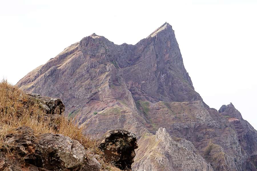
- Pico d’Antónia summit: At roughly 1,394 meters, it is the highest point on Santiago Island.
- A demanding one-way route: Plan on 4 to 5 hours of walking within a six-hour outing, with narrow and tilted sections.
- Long-distance island views: From near the summit, you may see the São Jorge Valley, Maio, and Fogo’s volcano when the air is clear.
- Helpful guiding: Guides speak English, French, Spanish, and Portuguese, and Elder has received special praise for patient support.
- Useful package value: Hotel pickup in Praia or São Jorge dos Órgãos, transport, insurance, a guide, and a simple picnic are included.
Starting in Rui Vaz and entering Monte Txota
Your day begins with pickup at your accommodation in Praia or São Jorge dos Órgãos, followed by the drive to Rui Vaz. This matters because the trail is not presented as a walk from town. Transport gets you to the high-country starting point and returns you after the route, so you can focus your energy on the mountain rather than on finding a taxi.
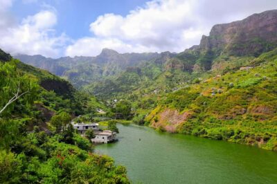
Monte Txota begins at about 800 meters above sea level. Its height gives it a cooler micro-climate, making this one of the more comfortable places on Santiago for walking, particularly compared with the warmer lowlands. Bring a sun hat and sunscreen anyway. Cool air can make the sun feel less severe than it is.
The park is valuable as more than a warm-up section. You get a look at Santiago’s upland ecology before the route becomes more exposed and strenuous. The setting has plenty of biodiversity, and a guide can help you notice the plants and explain the natural setting instead of reducing the walk to a simple uphill slog.
This is where a good guide makes a real difference. The guide is expected to lead in several languages, including English, French, Spanish, and Portuguese. If Elder is leading your departure, you can expect a guide who has been praised for explaining the surrounding plants in plain language and for watching the group’s safety during harder stretches.
A few more Praia trips to weigh up
- Serra Malagueta: Principal Valley Hike & Lunch with Locals
★ 4.7 · 64 reviews - Praia: Baobab Mysterious Tree, Green Valley & Old City Hike
★ 4.8 · 53 reviews - Santiago: Calabaceira Valley Trek & Visit to Cidade Velha
★ 4.8 · 49 reviews
The climb toward Santiago’s highest point
From Monte Txota, the route continues toward Pico d’Antónia. The summit reaches approximately 1,394 meters, or about 1,400 meters in the route notes. That makes it Santiago’s highest point and gives the climb a clear purpose. You are not simply walking through hills. You are working toward the island’s top.
The total trail distance is about 9 kilometers, with roughly 660 meters of elevation gain. The route information also lists about 1,280 meters of descent, which is a reminder that the day involves more than a steady climb and return along the same path. It is described as one way, with the walk ending back at Monte Txota before the ride to your hotel.
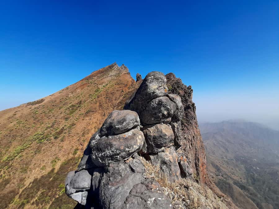
Expect narrow, tilted paths. Some parts may call for a basic level of climbing, and walking sticks are strongly advised. Hiking pants are especially useful from August through November, when brush and trail conditions may make bare legs a poor choice.
I would not book this based only on the summit height. The more important question is how you feel about several hours on uneven ground, including a demanding descent. You should have some fitness and no health problems that make sustained exertion risky. The outing is not suitable for pregnant people, wheelchair users, people with mobility impairments, or people with respiratory issues.
The route is for people over 16. That age rule fits the nature of the walk. This is not a family stroll where the slowest member can simply wait at the next viewpoint. The group needs to keep moving along a one-way trail, and the descent can be as tiring as the climb.
Views from Pico d’Antónia
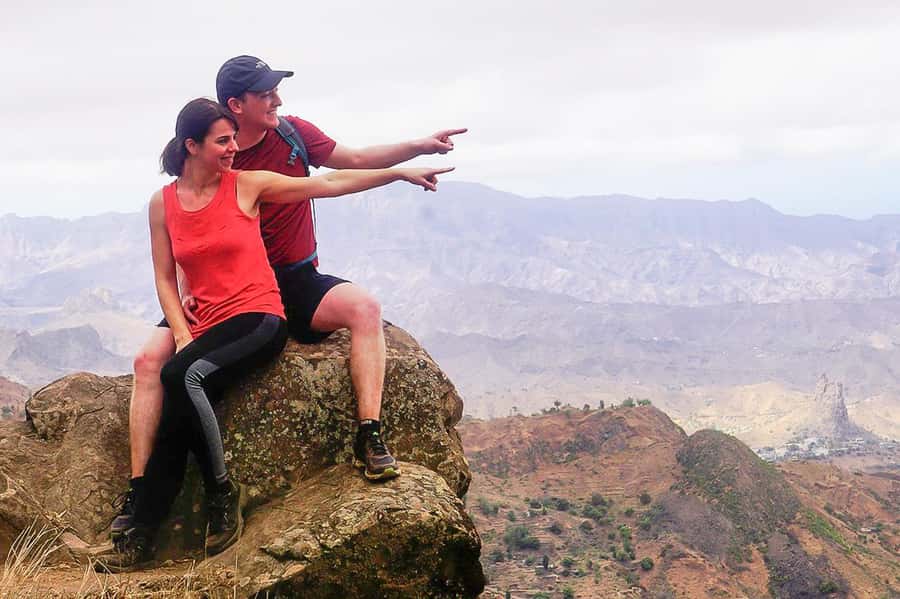
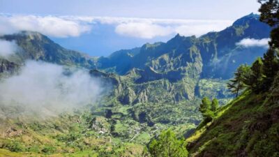
As you approach the top, the reward is the view over the São Jorge Valley. From this height, Santiago’s towns and surrounding areas spread out below. The exact view depends on cloud, haze, and weather, so keep expectations flexible.
On a clear day, you may see Maio Island and the volcanic peak of Fogo Island in the distance. These sightings are weather-dependent, not guaranteed. That is worth understanding before you pay for a mountain day built around long views. Even with cloud blocking the far islands, the summit remains the highest point on Santiago and the route still gives you a strong sense of the island’s upland terrain.
The view is also one reason to avoid rushing the final section. The walk gets harder near the top, but the elevated viewpoint puts Santiago into perspective. You can see why this island’s geography changes so much from one area to another: cooler high ground, valleys below, and distant islands beyond the sea.
The best approach is to treat Maio and Fogo as welcome extras. The main prize is Pico d’Antónia itself and the views across Santiago.
A picnic break with practical limits
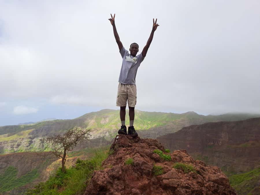
A small picnic is included: a sandwich, fruit, and a soft drink. It is a useful break after several hours of walking, but it is not a full meal. Bring your own water and drinks, as the instructions specifically tell you to carry them.
I would pack more food if you normally eat a large lunch after a hard hike. The included picnic covers a basic pause without adding much weight to your day, but the route’s difficulty makes hydration and personal snacks important. You should not depend on the soft drink as your main source of fluid.
The pause also gives you a chance to slow down and take in the views. On a strenuous route, that matters. A picnic stop can help you recover before the return section, though you should still expect the walk to take about 4 to 5 hours in total.
The published duration is six hours, including the drive and walking. Pickup timing can vary, so wait in your hotel lobby 10 minutes before the scheduled time. The driver holds a sign with your last name and will wait no more than five minutes after pickup time. That is a good reason to be ready early, especially if you are staying in a larger hotel.
Same archipelago, a completely different island day:
- Santiago: Landscapes, Street Art, and Markets Day Trip
★ 4.8 · 316 reviews - From Port of Praia: Island Tour for Cruise Ship passengers
★ 4.5 · 190 reviews - Praia & Cidade Velha: Guided City Tour
★ 4.8 · 80 reviews - From Praia: Boat Trip, Snorkeling, Cave & BBQ on the Beach
★ 4.6 · 45 reviews
Guides, pacing, and group size
Guiding is one of the strongest reasons to choose an organized hike here. The path is narrow and tilted in places, and a guide can help with footing, route decisions, and pacing. This is particularly useful when the trail becomes more technical near the summit or during the descent.
The outing is available as a private or small-group trek. A shared group requires at least two participants. If that minimum is not reached, the operator may offer another date, charge an extra amount to operate privately, or cancel with a full refund.
A small group can make a hard route easier to manage. You spend less time waiting and have a better chance of walking at a sensible pace. A private outing may be worth considering if your group has different fitness levels or if you want more flexibility for stops.
Pacing is important here. One departure was praised for following the group’s pace, while another singled out the guides and driver for excellent service. The comments also highlight Elder’s empathy and support during difficult moments. I would still tell the guide at the start if you are worried about the downhill section, not just the climb.
The route should not be treated as a race. A guide who watches the group and explains the surroundings can turn a hard outing into a safer and more rewarding one. You should be comfortable speaking up if you need a short pause.
What to wear and carry for the 9 km trail
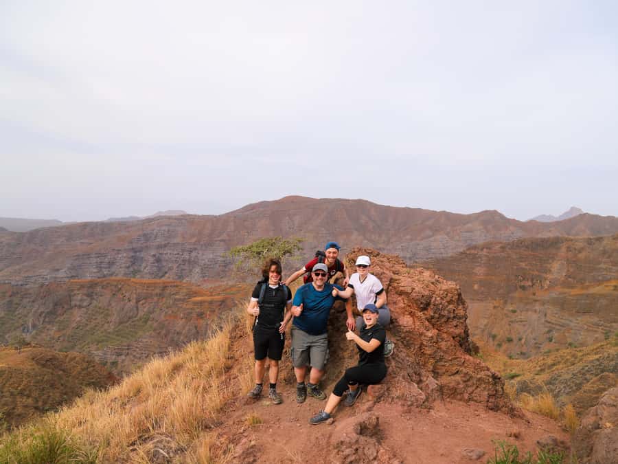
Take the preparation list seriously. Hiking shoes are essential, and walking sticks are a smart addition for the sloping ground and long descent. Wear a hat, apply sunscreen, and carry water from the start.
Hiking pants are strongly recommended from August through November. That advice is practical, since the trail may include brush and sections where bare legs are exposed to plants or rough ground. Choose clothing that lets you move freely and protects your legs.
Your basic day pack should include:
- Water and extra drinks
- A sun hat
- Sunscreen
- Hiking shoes
- Walking sticks
- Personal snacks if you need more than the included sandwich and fruit
- Hiking pants, especially from August through November
Do not count on the cool Monte Txota air to remove the need for sun protection. Conditions can change as you gain or lose height, and the summit section may feel different from the sheltered park.
What the $100 price really covers
At $100 per person, this is not just a guided walk. The price includes pickup and drop-off in Praia or São Jorge dos Órgãos, transport to and from the trail, a guide, liability insurance, and the picnic. For a remote mountain route with a one-way trail, those inclusions add real value.
The strongest savings are in time and transport. Organizing a private ride to Rui Vaz, arranging a return transfer from Monte Txota, and finding a guide would take effort and could cost more than expected. Here, those pieces are arranged together.
The price is less attractive if you are already based outside Praia or the stated pickup area, since an extra pickup and drop-off fee applies for customers who are not in Praia. Check that charge before booking so the final cost is clear.
I also would not compare this with a short city tour. You are paying for a six-hour mountain outing and a guide on difficult ground. If you want a serious Santiago walking day and do not have your own transport, the package is reasonably strong. If you want an easy viewpoint with little exertion, it is poor value because much of the day is spent walking uphill and downhill.
Free cancellation up to 24 hours before the activity and reserve-now, pay-later booking make the commitment less rigid. Still, weather affects the distant views, so book this for the hike itself rather than for a guaranteed sighting of Fogo.
Who should book this hike
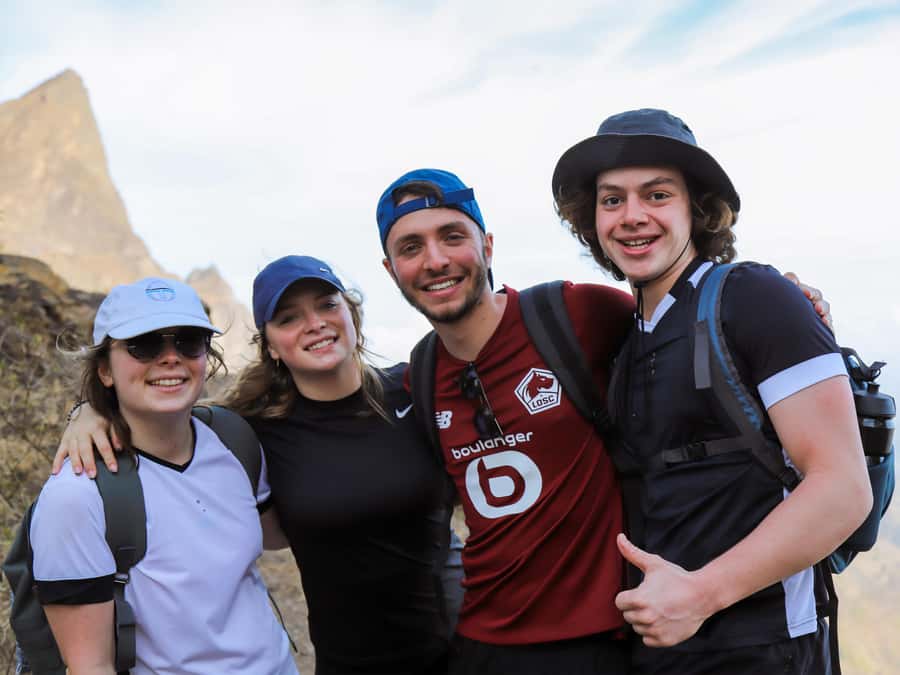
I would recommend it to fit walkers over 16 who want Santiago’s high country rather than a quick stop in Praia. It suits you if you enjoy a full morning or afternoon on foot, accept a hard trail, and want a guide to add context to the plants, valleys, and scenery.
It is also a good choice if you are staying in Praia or São Jorge dos Órgãos and do not want to arrange mountain transport. The included transfer keeps the day simple, and the picnic means you do not need to organize lunch before leaving.
Think twice if you have breathing problems, reduced mobility, or difficulty with steep descents. The route’s 1,280-meter stated elevation loss is significant, and the tilted path can be harder on knees and ankles than the uphill section.
You should also avoid booking it just because the words highest point sound impressive. The summit is worthwhile, but getting there requires steady effort. Ask yourself if you are happy with narrow trails, a possible basic climbing section, and four to five hours of walking.
FAQ
How long does the Pico d’Antónia hike take?
The full activity lasts about six hours. The walking portion takes approximately four to five hours, with a short picnic stop along the way.
How far is the trail?
The route is approximately 9 kilometers.
How difficult is the hike?
It is rated difficult. The route includes about 660 meters of ascent, about 1,280 meters of descent, narrow and tilted paths, and a maximum elevation of roughly 1,400 meters.
What is included in the price?
The $100 price includes pickup and drop-off at accommodation in Praia or São Jorge dos Órgãos, transportation, a tour guide, liability insurance, and a picnic with a soft drink, sandwich, and fruit.
Can I see Maio and Fogo from the summit?
You may see Maio Island and the volcano on Fogo Island when weather and visibility are good. These distant views are not guaranteed.
What should I bring?
Bring a sun hat, drinks and water, hiking shoes, sunscreen, and walking sticks. Hiking pants are strongly advised from August through November.
Should you book Monte Txota to Pico d’Antónia?
Book this tour if you want a demanding mountain day with transport, a guide, and a real summit goal. The cool Monte Txota section, views from Santiago’s highest point, and chance of seeing Maio and Fogo give the route plenty of character.
Skip it if you need an easy walk or have health and mobility concerns. For prepared walkers, the $100 package offers good practical value, especially with pickup, insurance, and a guide who can manage the difficult sections. Go for the mountain and the changing scenery first. Treat the distant islands as a bonus.
Just added around Praia
- Hiking Águas Belas Cave★ 4.5 · 3 reviews
- Tour Old City/Discover Old Town★ 4.0 · 8 reviews
- Santiago Island: 4-Hour Calabaceira Valley Hike & Guided Tour to Cidade Velha★ 5.0 · 18 reviews
- Tarrafal Beach Tour: Boat Trip to the Lighthouse, Snorkel & BBQ Lunch★ 5.0 · 5 reviews
- Santiago Island: Private Airport Transfer to Praia or Vice Versa★ 5.0 · 3 reviews
- Best of Santiago Island: Cidade Velha, Workshop & Tarrafal Beach Tour★ 4.5 · 3 reviews
- Private Tour of Santiago – Discover the Island★ 4.5 · 18 reviews
- Santiago Island: Banana Plantation, Natural Park & Workshop with a local family★ 5.0 · 10 reviews
Hiking & Trekking, compared.
Serra Malagueta: Principal Valley Hike & Lunch with Locals
Read our review →
Baobab Mysterious Tree, Green Valley & Old City Hike
Read our review →
Browse the lists this tour appears in